Contributers
Co-Author: Dr. Abdulla Noaman is a professor at the department of civil engineering and in the Water and Environmental Centre (WEC) at Sana’a university. Dr. Noaman is a member of IAHS (International Association of Hydrologist) and Gulf Water Science & Technology Association (WSTA).
Co-Author: Dr. Fadhl Ali Al-Nozaily is A Professor at the Department of Civil Engineering, Faculty of Engineering of Sana’a University, Yemen. He is a Vice director of Water and Environment Centre, Sana’a University and a member of Gulf Water Science & Technology Association (WSTA).
Peer Reviewer: Dr. Mohammed Hezam Al-Mashreki, is an Associate professor at the Renewable Natural Resources Research Centre of the Agricultural Research & Extension Authority, Yemen. He is a national coordinator for the Global Soil Partnership (GSP) and a National Counterpart of IAEA’s Soil & Water Projects. He is also a peer reviewer for some national and International Journals. He is a member of national and regional land & water scientific associations and received a number of awards for contributions to his field of investigate.
Introduction to water in Yemen
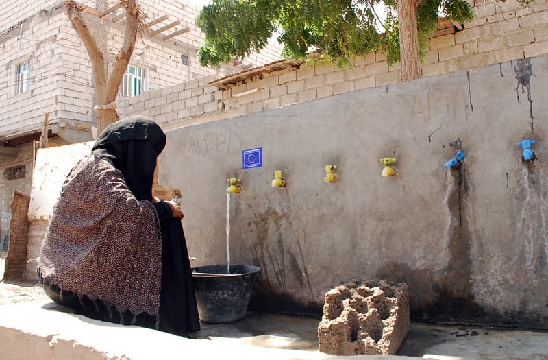
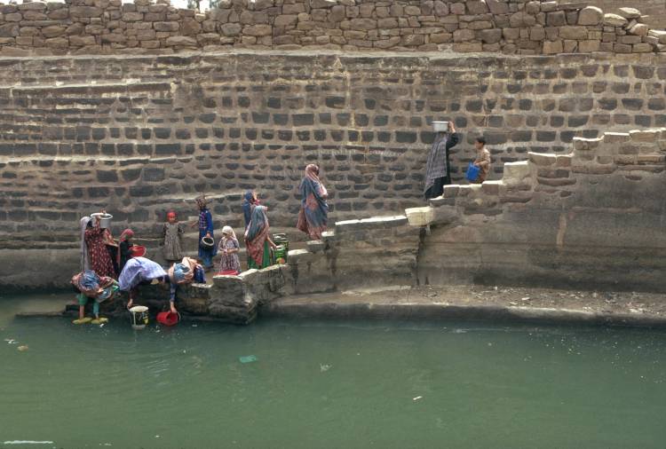
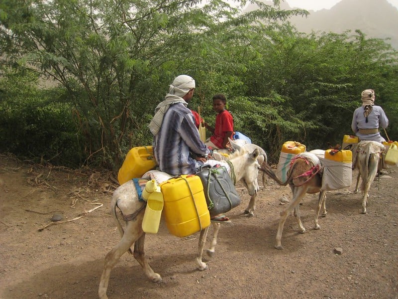
Located in a dry and semi-arid region on the Arabian Peninsula, the Republic of Yemen is facing a severe water crisis. The country is physically water scarce due to its limited rainfall and geographic location with no shared international rivers. However, this scarcity extends beyond physical water availability; Yemen is also economically water scarce.[1] It is currently the seventh most water-scarce country in the world, with the per capita share of renewable water resources only around 80 cubic metres (m3).[2]
It is estimated that the amount of water required during the next decade to meet the growing demand will be about 4.5 billion cubic metres (BCM). The water deficit in 2000 was 700 million cubic metres (MCM), rose to 900 MCM in 2010 and is expected to reach 2,500 MCM in 2025. Most of the water comes from groundwater sources – springs, wells, boreholes – and this has led to serious groundwater depletion as withdrawals far exceed annual recharge.[3]
Geography and climate
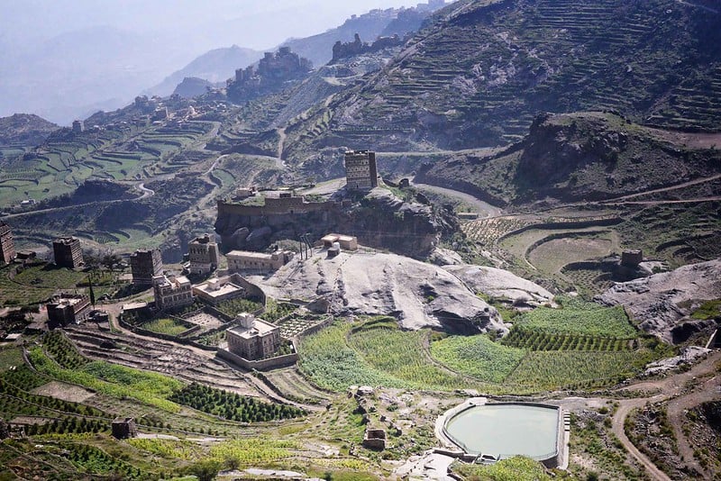
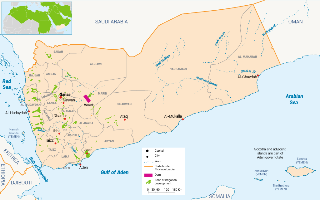
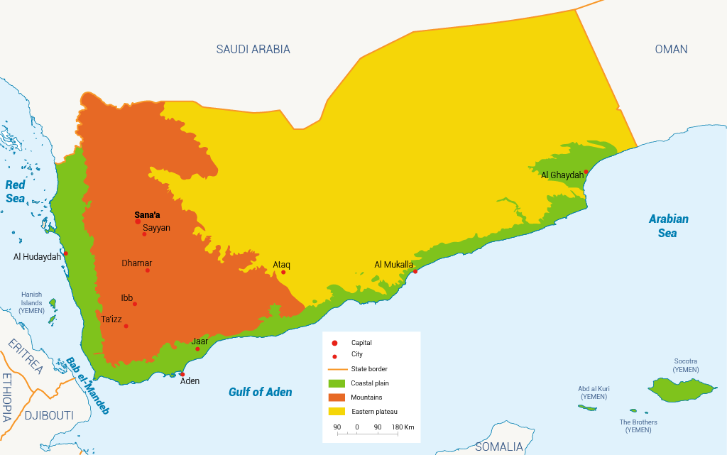
Yemen is located in the south-western corner of the Arabian Peninsula (map 1). The country is administratively divided into 21 governorates (provinces), with a total area of about 445,500 square kilometres (km2) that consists largely of mountains and deserts. Environmentally, Yemen can be divided into four major agro-ecological regions: the coastal plains, the mountains, the eastern plateau and the islands. There are many islands, the largest of which are Socotra in the Arabian Sea and Kamaran in the Red Sea (Table 1).[4]
Yemen has a predominantly semi-arid to arid climate, with rainy seasons during spring and summer and high temperatures prevailing throughout the year in low-altitude zones. This is primarily a consequence of the country’s latitude.
This causes intense solar radiation and brings the area during spring and summer under the influence of the intertropical convergence zone, a belt of converging trade winds and rising air that encircles the Earth near the equator. The southern highlands receive 520-760 millimetres (mm) of rain per year. The south-western highlands, most notably Ibb city, receive more than 1,500 mm of rain each year.[5]
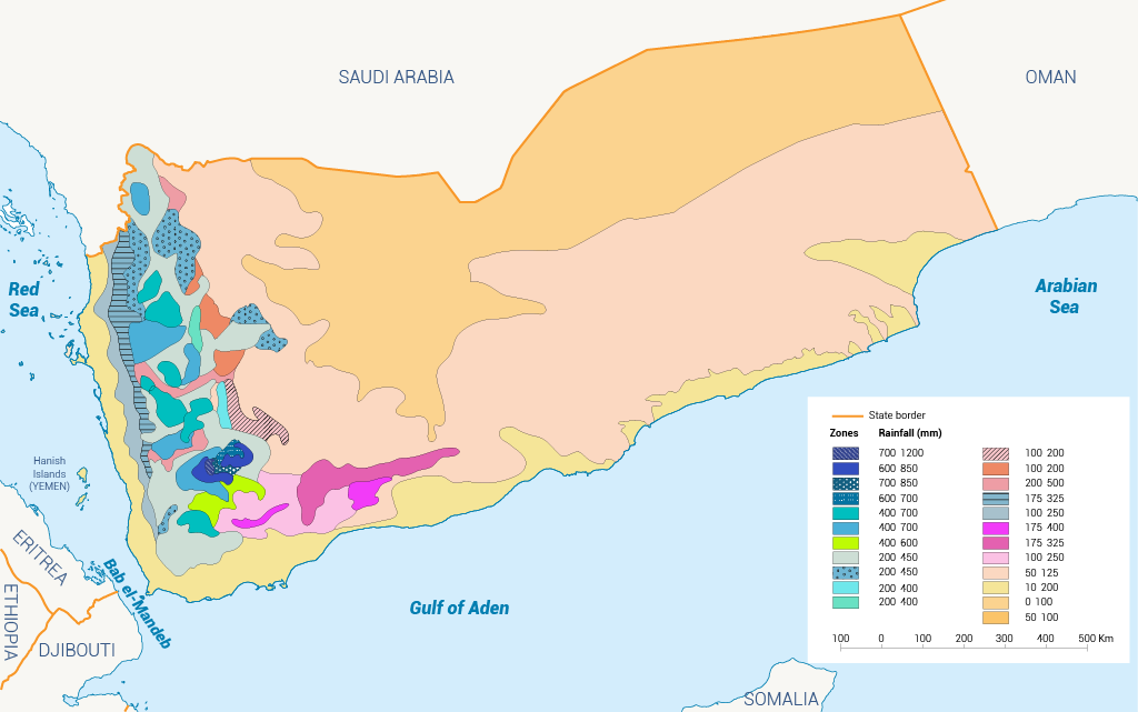
In terms of aridity, the ratio between average annual precipitation (P) and annual reference evaporation (E) in principle marks five different zones (Map 3). The climate varies from hyper-arid (deserts, most of the plateaux, parts of the coastal plains) to sub-humid (scattered wetter zones on the western and southern slopes of the mountains), with small humid areas in Ibb province.[6]
Table 1: Yemen’s physiographical regions. [7]
| Regions | Sub- devision |
| Coastal plains | (a) Tihama (b) Tuban-Abyan plains (c) Ahwar-Meifaah plains (d) Eastern coastal plains |
| Mountains | (a) Western slopes (b) Southern slopes (c) Eastern slopes (d) Highland plains zone |
| Eastern plateau | (a) Northern plateau zone (b) Southern plateau zone (c) Wadi Hadramawt (d) Al Ghaydah basin |
| Deserts | (a) Ramlat as-Sabatayn (b) Rub al-Khali |
| Islands | (a) Socotra – Kamaran (b) Other small islands |
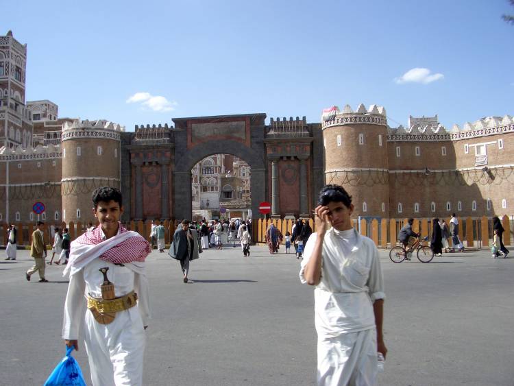
Population
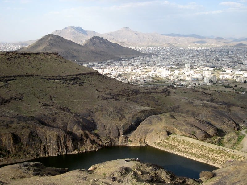
Yemen has one of the highest rates of population growth in the world. This was around 1.4% in 1960, rose to 4.5% in the early 1990s and had dropped to 2.5% annually by 2016.[8] In 1990, the population was 12.3 million. The current population is 29.3 million, with a growth rate of 2.3%. The population is increasing most rapidly in cities; hence, water availability is decreasing most rapidly in cities. Figure 1 shows the population density across the country and the projected population growth over the next few decades. It is evident that the majority of the population is clustered in cities like the capital Sanaa, Aden and Taiz. It can also be seen that the current population growth rate of 2.3% is expected to drop to 2% by 2025 and to 1% by 2050.[9]
Economy
The FAO’s Yemen Plan of Action 2018-2020 indicates that Yemen has been among the poorest countries in the world for decades.[10] It is now facing the world’s largest humanitarian emergency. Instability, violence and import/export restrictions since the outbreak of war in 2015 have devastated the economy. The GDP has declined by 41% since March 2015 – equivalent to a loss of $32 billion (or $1,180 per capita). Since 2015, the currency has lost 80% of its value – 28% in 2017 alone. Losses in infrastructure have been estimated at $19 billion, bringing massive service disruption across all sectors.
Prior to the conflict, agriculture and fisheries contributed between 18-27% of GDP, 25-30% of the annual food requirement and employed more than 50% of the workforce. These percentages are now shrinking as the agriculture sector has been one of the worst hit by the war and local food production has been severely compromised.[11]
[1] Al-Mashreki M, 2013. Status of land tenure, land management and land use planning in Yemen. Land Management and Land Use Planning in Yemen (Part II). FAO, Regional Office for the Near East, Cairo, Egypt.
[2] National Organization for Defending Rights and Freedoms, 2011. Alternative Report Submitted to the Committee on Economic, Social and Cultural Rights in the Context of the Review of the Second Periodic Report of Yemen
[3]Ali W and al-Kadasi F, 2011. Change: Policy Implications – The Case of NWSSIP II. A Policy Note. National Sector Strategy and Climate Change. UNDP Publications.[4] AI-Mashreki M et al., 2012. Combating Land Degradation in Yemen. A National Report. Working Papers 253876, International Center for Agricultural Research in the Dry Areas (ICARDA).
[5] Ministry of Water and Environment, 2010. Baseline Survey for Future Impact Evaluation. Sanaa Basin Water Management Project. MWE: 107.
[6] Ministry of Water and Environment, 2010. Baseline Survey for Future Impact Evaluation. Sanaa Basin Water Management Project. MWE: 107.
[7] AI-Mashreki M et al., 2012. Combating Land Degradation in Yemen. A National Report. Working Papers 253876, International Center for Agricultural Research in the Dry Areas (ICARDA).
[8] FAO, 2018. Yemen Plan of Action 2018-2020.
[9] The World Bank, 2017. Yemen population growth (annual %).
[10] FAO, 2018. Yemen Plan of Action 2018-2020.
[11] FAO, 2019. Yemen Famine Prevention Plan. January-June 2019.