Surface water
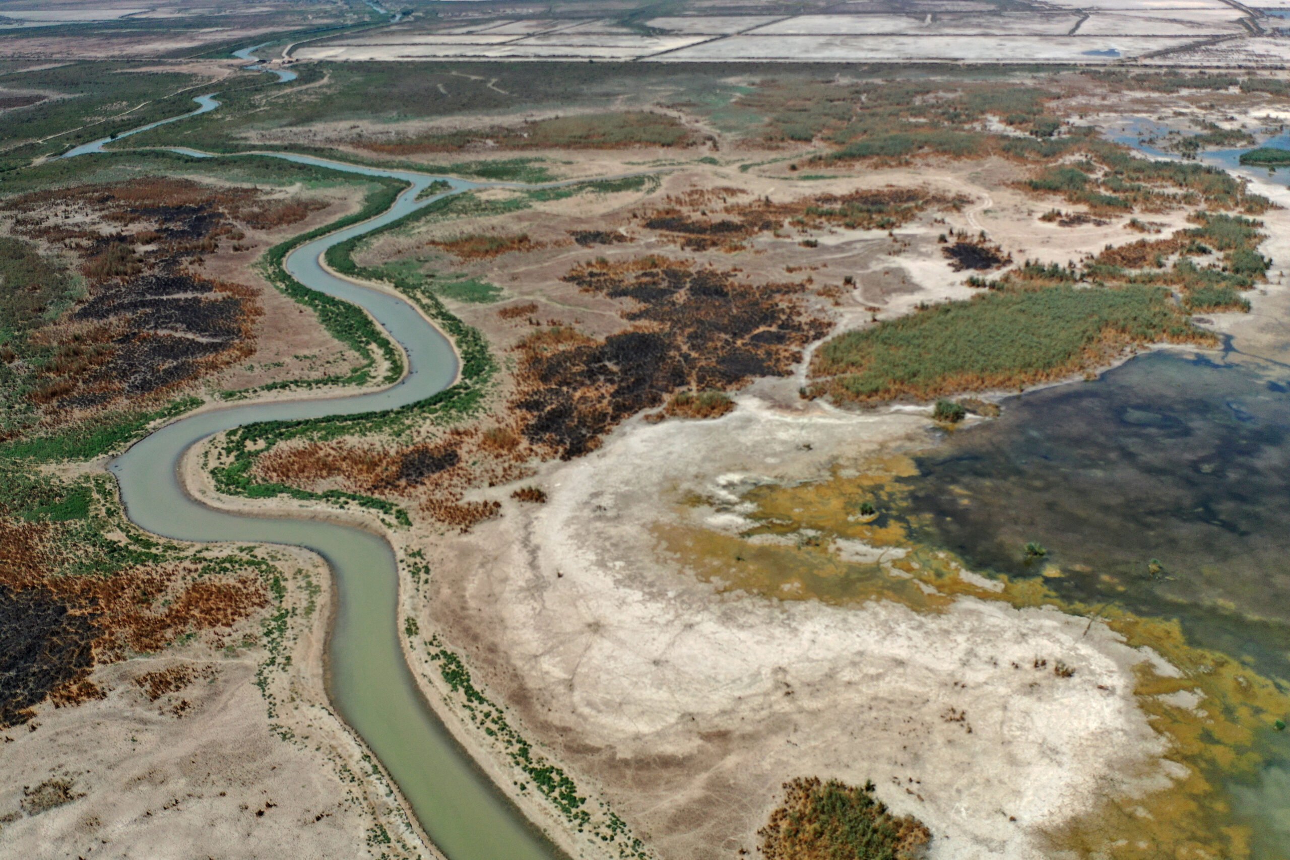
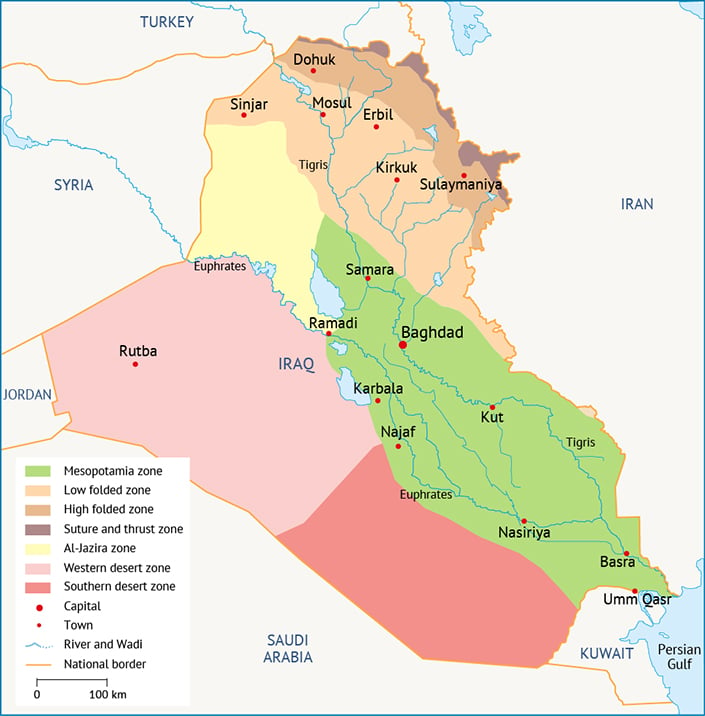
The two dominant rivers in Iraq are the Tigris and Euphrates. The watersheds, including their tributaries, account for 100% of the country’s surface water. These fabled rivers, which helped feed the Garden of Eden in the Book of Genesis, now provide drinking water, supply industry and irrigate massive swathes of farmland.
Both the Tigris’ and Euphrates’ main stems are transboundary rivers, originating in Turkey. Before their confluence into the Shatt al-Arab, the Euphrates flows for about 1,000 kilometres (km) and the Tigris for about 1,300 km inside Iraq’s borders. The fact that these important rivers do not originate in Iraq has been a long-standing source of tension with its riparian neighbours and puts the country in a difficult position when trying to plan for and manage its water resources.
In addition to these major rivers, there are a number of major tributaries, including the Greater Zab (which originates in Turkey); the Lesser Zab (which originates in Iran); the Diyala (which originates in Iran); the Adhaim, which drains about 13,000 square kilometres (km2) entirely in Iraq; and the Nahr at Tib, Dewarege and Shehabi rivers, together draining more than 8,000 km2. In southern Iraq, the Karkheh River, the main course of which is in Iran, brings over 50,000 km2 of water and flows inside the Hawr al-Hawiza marsh, which is connected downstream with the Tigris and Euphrates system.[1] The most significant downstream tributary is the Karun River, with a catchment of about 67,000 km2, which has a primary impact on salinity intrusion along the Shatt al-Arab.[2]
The total natural run-off of the Euphrates watershed is estimated to be between 27 billion and 35.1 billion cubic metres per year (BCM/yr), while the Tigris watershed, including its tributaries, is between 41.2 and 58.3 BCM/yr.[3] These estimates vary considerably between sources, a disparity that has two causes: the scarcity of data released by qualified authorities and the high variability of the flow recorded at gauging stations. Despite this discrepancy in the amount of natural contribution of the two rivers to Iraq, it is generally acknowledged that the amount of surface run-off has been reduced by upstream impairment in the order of 30%. This impact is forecasted to increase further in the next 20 years, reducing the water available to Iraq by up to 60%.[4]
The geology of some regions is dominated by limestone, leading to the development of extensive karst aquifers in the north-east of the country and in the deserts in the south. Hydraulic parameters in these aquifers are highly variable, presenting a challenge to the monitoring of groundwater dynamics.[5] Local groundwater resources are often also part of larger aquifer systems that are shared with neighbouring countries.
Groundwater recharge originates from three main sources: naturally from precipitation and the infiltration of surface water, and artificially from irrigation in agriculture. Recharge occurs mainly in the northern, more rain-laden areas of Iraq, where recharge rates can reach 100-300 mm/yr. Groundwater recharge in the south is negligible at less than 20 mm/yr.[6] While the annual recharge and sustainable groundwater yield has been estimated at around 5 BCM/yr, i.e. a fraction of the country’s surface water resources,[7] Iraq’s annual active groundwater recharge rate is still not fully understood.
Groundwater storage is very sensitive to the consumption and availability of surface water, to the extent that any changes in withdrawal from wells can affect discharge along a river, and any changes in streamflow can affect the volume of available groundwater. Therefore, if the amount of surface flow coming into Iraq from its upstream riparian neighbours is reduced as much as forecasted, there will also be a significant impact on groundwater systems.[8]
Non-conventional sources
In 2014, the Iraqi government commissioned an international consortium to construct the country’s first major desalination plant in Hartha, 20 km north of Basra. Construction was completed in 2019. The reverse-osmosis plant is designed to desalinate 199,000 m³ of brackish water from the Shatt al-Arab per day, providing drinking water to 400,000 people in Basra. It is part of a larger government project to improve water supply in the Basra governorate. Plans for another large-scale desalination plant in Fao along the Gulf coast are currently being developed.[9]
Wastewater reuse
The current reuse of treated wastewater in Iraq is negligible, for two key reasons: first, wastewater treatment infrastructure capacity across the country is limited, particularly in rural areas, and second, knowledge of the efficient reuse of wastewater is lacking in the water sector.[10] While there are some pilot projects on the use of treated municipal wastewater in agriculture, broad application has been missing so far.[11] Recommended uses for treated wastewater include municipal, such as street cleaning and watering of park spaces, agricultural, such as irrigation of fodder crops, and industrial, such as cooling in industrial processes and energy production.
Rainwater harvesting
Macro rainwater harvesting schemes, usually in the form of dams along wadis, play an important role in the management of Iraq’s water resources. They allow for the retention of rainwater after high-intensity rainfall, which can then be used to replenish groundwater resources. In the 1970s and 1980s, small dams were constructed in many wadis across the country to unlock rainwater harvesting potential in the face of increasing water scarcity. Many of these dams have been affected by the build-up of sediment in their reservoirs, reducing the storage capacity.[12] In recent years, numerous studies have been conducted on the current and future suitability of different locations for new rainwater harvesting schemes, both in the north and arid south.[13] However, information on the actual implementation of such projects is sparse.
Reuse of drainage water
Due to the low overall irrigation efficiency in Iraq, most drainage water is returned to rivers, with only a portion of it being collected and reused. The Ministry of Water Resources plans to modernize its drainage water collection system in order to better reuse irrigation water, which is critical to meeting the country’s future water needs.[14] Among other things, the treated water can be used for oil well re-injection, creating green belts to combat desertification and augmenting the water available for the Mesopotamian Marshes of southern Iraq.
Total water availability
Although exact numbers vary widely, the most recent numbers in the FAO’s AQUASTAT database (2018) indicate that Iraq has access to approximately 100 BCM of renewable water resources per year, equivalent to 2,338 m³ per capita per year (Figure 1).
This includes around 96.5% surface water resources and around 3.5% renewable groundwater resources. Iraq receives approximately 38% of its renewable water resources from within the country, whereas the remaining 62% enter Iraq from one of its neighbours.[15]
Figure 1. Iraq’s estimated annual renewable water resources.[16]
[1] CGIAR, 2004. Challenge Program on Water and Food, Karkheh Basin profile: Strategic research for enhancing agricultural water productivity.
[2] Sadeghian, M S et al., 2003. ‘Optimising the River Karun system, Iran’. Transactions on Ecology and the Environment vol. 60.
[3] Kliot, N, 1994. Water Resources and Conflict in the Middle East; Kolars, J and Mitchell, W, 1991. The Euphrates River and the Southeast Anatolia Development Project: The Middle East Imperative; Altinbilek, D, 2007. ‘Development and management of the Euphrates-Tigris basin’. International Journal of Water Resources Development 20(1): 15-33.
[4] Ibid.
[5] Krásný, J, Alsam, S and Jassim, S Z, 2008. ‘Hydrogeology’, in Jassim, S Z and Goff, J C (eds) Geology of Iraq. Prague, Dolin, pp. 251-287.
[6] United Nations Economic and Social Commission for Western Asia; German Federal Institute for Geosciences and Natural Resources, 2013. Inventory of Shared Water Resources in Western Asia.
[7] Alwash, A, Istephanian, H, Tollast, R and Al-Shibaany, Z Y (eds), 2018. Towards Sustainable Water Resources Management in Iraq. Iraq Energy Institute.
[8] Kliot, N, 1994. Water Resources and Conflict in the Middle East; Kolars, J and Mitchell, W, 1991. The Euphrates River and the Southeast Anatolia Development Project: The Middle East Imperative; Altinbilek, D, 2007. ‘Development and management of the Euphrates-Tigris basin’. International Journal of Water Resources Development 20(1): 15-33.
[9] Iraq Energy Institute, 2020. ‘Iraq and the desalination revolution: First steps, future trends’. Published 1 May 2020.
[10] Aziz, A and Aws, A, 2012. Waste Water Production, Treatment and Use in Iraq; Dunia Frontier Consultants, 2013. Water and Sewage Sectors in Iraq: Sector Report – February 2013.
[11] Dzhumagulova, N T and Abdulameer, L S, 2021. ‘The use of treated waste water for irrigation purposes in the administrative district of Kerbala, Iraq’. IOP Conference Series: Materials Science and Engineering vol. 1067.
[12] Abdullah, M, Al-Ansari, N and Laue, J, 2020. ‘Water harvesting in Iraq: Status and opportunities’. Journal of Earth Sciences and Geotechnical Engineering 10(1).
[13] See for instance: Adham, A et al., 2018. ‘A GIS-based approach for identifying potential sites for harvesting rainwater in the Western Desert of Iraq’. International Soil and Water Conservation Research 6(4): 297-304; Adham, A et al., 2022. ‘Sustainability of the Al-Abila Dam in the Western Desert of Iraq’. Water 14(4); Alwan, K K et al., 2019. ‘Validity of existing rain water harvesting dams within part of Western Desert, Iraq’. Engineering 11(12): 806-818.
[14] Ministry of Water Resources of Iraq, 2014. Strategy for Water and Land Resources of Iraq 2015-2035.
[15] FAO (Food and Agriculture Organization of the United Nations), 2022. AQUASTAT database.

