Contributors
Authors: Paolo Mastrocola is a water resources management engineer; he has been working in Iraq for the last 10 years providing consultancy services to both governmental and non governmental organizations. He was involved in the New Eden Master Plan for marshlands restoration developed by Nature Iraq NGO and in the Water Resources Master Plan recently completed by the Ministry of Water Resources.
Peer Reviewer: Paolo Polo, Water Resources Management, Hydro Nova LLC.
Introduction
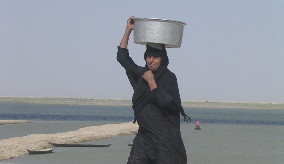
The Iraqi Marshes are located in the lower Mesopotamian basin, in the vast floodplain wetlands created by the Tigris-Euphrates river system. The marshlands used to be the largest wetland ecosystem in Western Eurasia, representing a rare aquatic landscape in the desert and providing a habitat for important populations of wildlife. The marshlands form a triangular region bounded by three of the largest cities in southern Iraq: Nasiriyah to the west, Amarah to the north-east and Basra to the south. The inhabitants of the marshlands are known as Marsh Arabs.
Downstream of the capital Baghdad, approximately 500 kilometres from the head of the Persian Gulf, the very weak longitudinal slope of the land causes the two great rivers to meander and split into multiple branches, creating a chain of almost interconnected shallow freshwater lakes, marshes and seasonally inundated floodplains that typically overflow and merge into larger complexes during periods of high floods.
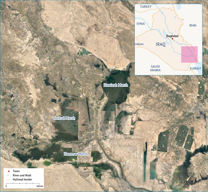
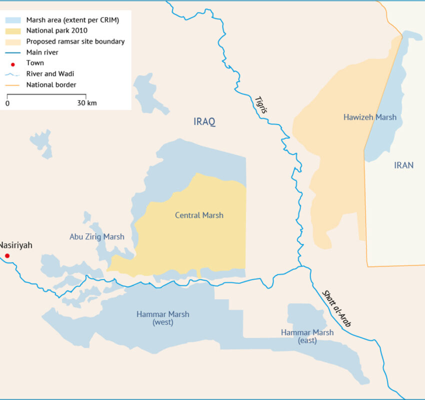
The average depth of water in the marshland is between 0.5 metres in the dry season and 2 metres in the wet season, and may be several metres deep in the permanent lakes. The Iraqi Marshes encompass three distinct areas: Hawizeh Marsh; Central Marsh, which formally includes Abu Zirig Marsh; and Hammar Marsh (Map 1). Current settlements and activities within and adjacent to the marshes include villages and towns, agricultural areas and oilfields.
Physical setting of marshlands
Climate
With less than 200 millimetres of annual rainfall, the climate in the marshlands is arid subtropical. It is characterized by hot summers (with average maximum temperatures around 43°C) and mild to cool winters (with average minimum temperatures around 4°C). In the summer, dust storms are common and heat waves can raise the temperature to 48°C. During the winter, the temperature can drop to -8°C. Humidity is low and evaporation from free water surfaces is high, causing water losses due to evaporation ten times higher than rainfall contribution over the area.[1]
Topography
Iraq consists essentially of a flat, low-lying plain that rises gently to the south-western plateau, reaching elevations of about 1,000 metres, and the north-eastern Zagros Mountains, which rise to elevations of up to 3,000 metres. Elevations on the almost featureless Mesopotamian Plain are characteristic of most of the country and vary from a few metres below sea level to about 400 metres above.
The primary source of water in the marshlands is the Tigris and Euphrates rivers, with several major tributaries flowing from Iran towards Tigris and Hawizeh. From the head of the Upper Mesopotamian Plain to the Gulf, the rivers meander slowly. The loss of velocity causes the rivers to deposit their silt, thereby building up their beds and banks above the level of the plain. This makes the rivers prone to overflow their banks seasonally and change course capriciously. Throughout history, the rivers have bifurcated and altered their courses on numerous occasions. It is believed that some of the deeper portions of the marshes (lakes) were former river courses that were cut off as the rivers changed course upstream.
The generally low slope of the plain decreases even further[2] in the lower portion of the Mesopotamian Plain. The Tigris and Euphrates split into many branches and form an interior delta. The branches, in turn, split into smaller distributaries that meander and shift. The levees are smaller and lower than in the Upper Mesopotamian Plain, the groundwater is closer to the surface and depressions between the channels become marshy.
Past the delta, the waters flow into the marsh and lake areas, where the land is essentially flat. At this point, the groundwater intersects the ground surface and groundwater outcrops, forming ponds.
The core of the marshes is centred around the confluence of the Tigris and Euphrates. It is usually divided into the three major areas: Hammar Marsh, to the south of the Euphrates; Central (Qurnah) Marsh, between the Tigris and Euphrates; and Hawizeh Marsh, to the east of the Tigris.
Historically, the marshlands constituted a chain of almost interconnected marsh and lake complexes that flowed into one another. During periods of high floods, large tracts of desert were under water. Consequently, some of the formerly separate marsh units would merge together, forming larger wetland complexes. The wetlands themselves were made up of a mosaic of permanent and seasonal marshes, shallow and deep-water lakes, and mudflats that were regularly inundated during periods of elevated water levels.
Further downstream, the Tigris and Euphrates join to form the Shatt al-Arab River, which flows into the Persian Gulf and is therefore influenced by tidal action.
Hydrology
Before the 1970s, there was a complex system of natural channels where the Tigris and Euphrates formed interior deltas upstream of the marshes, and the marshes created a highly interconnected system in which the rivers merged and disappeared. This natural system has been altered in the last century with the implementation of agricultural canals, drainage systems and hydraulic structures, which impact significantly the hydrological management of the entire system.
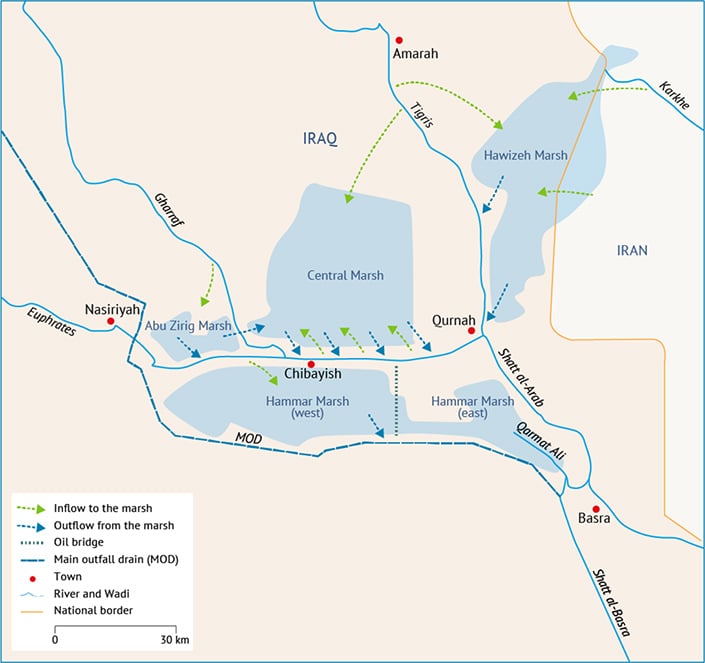
Water from the Tigris feeds the Hawizeh and Central marshes due to the inadequate carrying capacity of its channel. The main Tigris channel reduces its cross-sectional area as it nears the marshes; the river flow capacity decreases significantly.
The Euphrates is constrained by higher embankments all the way from Nasiriyah to Qurnah. Nevertheless, secondary branches exist and are able to connect the Central Marsh to the Euphrates via a number of breaches along the north embankment of the Euphrates. The Euphrates is divided into several arms downstream of Nasiriyah and flows into the Hammar Marsh along several secondary channels; the main branch of the Euphrates flows toward the confluence with the Tigris at Qurnah, but is currently blocked by a dyke that facilitates overflow through the wetlands.
Water from the Hammar Marsh flows into the Shatt al-Arab and Shatt al-Basra rivers through Qarmat Ali, whereas the Central Marsh flows into the upper reach of the Euphrates and then, at Qurnah, into the Shatt al-Arab. Water from the Hawizeh Marsh flows back into the Tigris and the Shatt al-Arab.
Map 2 illustrates the main connections between the marshes and the hydrological network.
History of marshlands
Formation of the marshes
The marshlands originated in the Holocene era. Some researchers claim that in about 5,000-4,000 BC, the marshlands were covered by a lagoonal marine environment, likely having brackish waters. With rising sea levels after a glacial period, the rivers began to deposit sediment and create vast deltas, which caused the shoreline to progress to its present location, possibly between 3,000-1,000 BC. The present fresh-to-brackish water environment is estimated to have been established around 3,000 years ago.[3]
Early history of the marshlands
Some of the earliest records of civilization are on the fringes of the marshlands. Little archaeological exploration has been carried out within the marshes themselves. Mounds, known as tells, rising above the marsh waters are believed to be the sites of ancient cities.
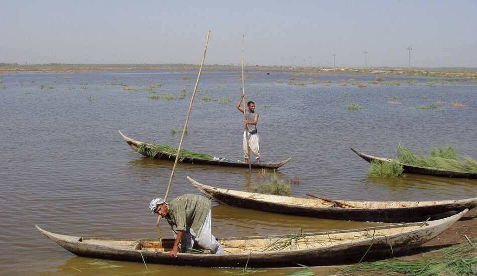
The Sumerians flourished around the marshlands between 3,000 and 2,000 BC. The Epic of Gilgamesh, the world’s first epic poem, mentions the marshlands: ‘Ever the river has risen and brought us the flood’. Artefacts in the Iraqi Museum represent Gilgamesh with water buffaloes in the Tigris and Euphrates. The boats used by marsh dwellers today are almost identical to those found at the Royal Cemetery of Ur. Clay tablets from the Sumerian period describe the marshes’ abundant wildlife.
The Sumerians were followed by the Assyrians. The Assyrians called the marshes Narmrtu (‘the bitter water’) or Tamdu Shamatu Kildi (‘the sea of the city of Kildah’).[4]
The Arab and Ottoman Empires
Historical sources indicate that the marshlands were small before the Arabs came to Iraq because the first rulers of the area took great care to drain the water gathered in the lands near Babylon. They dug canals and drainage systems across large areas and turned the land into fields. The Arabs called the lakes and marshes al-Bataih (‘the lands covered with torrents’). The areas around the marshes were well-populated.
With the advent of war and the increase in the size of the marshlands due to reduced irrigation and degraded flood control, the residents fled to higher ground. When the Arab (Islamic) Empire stabilized, the rulers did not know how to cultivate the land and dams were neglected. This further increased the area of flooded land. During the Umayyad Caliphate, only part of this area was cultivated.
In the following centuries, the area of the marshes fluctuated according to the intensity of the floods of the two rivers and the ability of the rulers of Iraq to control the river water. Different sources estimate the wetlands area ranged between 26,000 and 90,000 square kilometres.[5] The state and area of the marshes remained unchanged during the Ottoman Empire because the Ottomans neglected agricultural and drainage works. The Ottomans were also weak in their administration, controlling only the main cities in the marshlands.
The marshes in the 20th century
The most important development in the 20th century was the establishment of modern water controls in the Tigris and Euphrates basins. This led to a decrease in the great floods that had affected Iraq and consequently also the marshes. In addition, irrigation projects played an active role in determining the courses of the Tigris and Euphrates and their branches. A good indicator of the dramatic decrease in the water flow in southern Iraq is an evaluation of the current water use[6] in all the riparian countries (Turkey, Syria, Iran and Iraq): of the natural annual volume of about 90 billion cubic metres available in the entire watershed, about 60% is used by agriculture,
Figure 1. Current water use in the Tigris-Euphrates watershed.
10% is used by municipalities and industries, 15% is lost due to evaporation in lakes and reservoirs, with the remaining 15% left for environmental purposes, including the marshlands (Figure 1).
Impact of dams
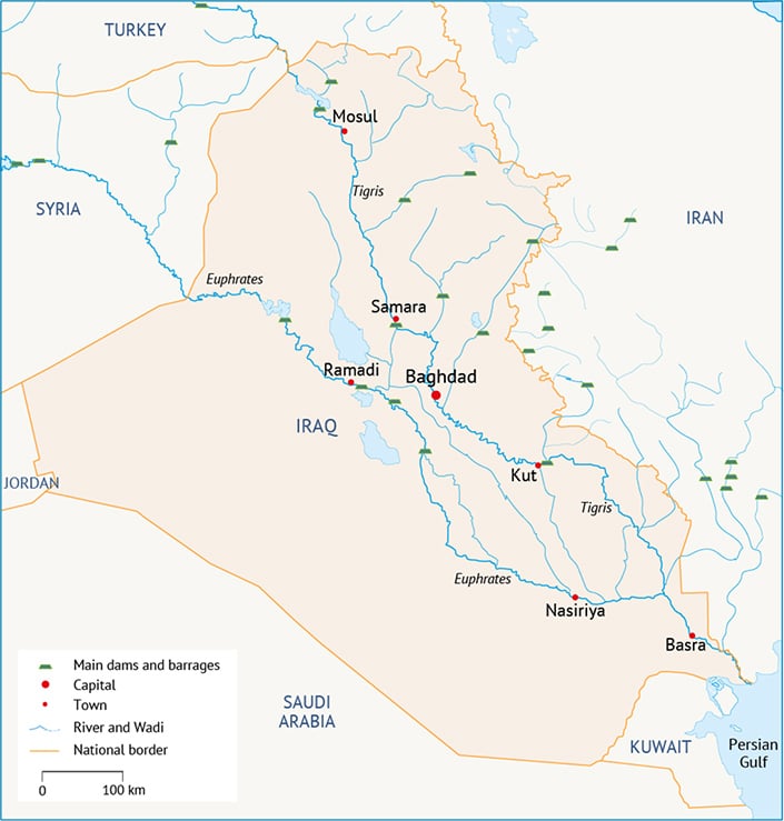
Since the marshlands are located at the tail end of the Tigris-Euphrates watershed, water storage and control projects are the main projects impacting on the wetlands. Hindiya Barrage on the Euphrates was inaugurated in 1913. This structure controlled the distribution of water downstream. It also controlled water and its distribution among the agricultural fields that were not a part of the marshes. This greatly affected the amount of water flowing to the Hammar Marsh. As far as the other marshes are concerned, Kut Barrage was constructed in 1938, which directed more water flow to supply irrigation for agriculture, thereby decreasing the amount of water flowing from the Tigris into the Central and Hawizeh marshes. Since the 1950s, Iraq has embarked on the construction of a number of new control infrastructure projects, including Samarra Barrage (on the Tigris) and Ramadi Barrage (on the Euphrates), which have diverted excess water towards natural depressions. Haditha Dam on the Euphrates and Mosul Dam on Tigris were completed in the 1980s. Similarly, Turkey and Syria initiated dam construction projects in the 1960s and 1970s. In 1990, the GAP project in Turkey went online, significantly impacting the Euphrates’ flow. At the same time, Iran implemented a massive impairment of the Tigris tributaries.
This occurred mainly in the 1950s in Iraq and in the 1980s and 1990s in Iraq, Turkey and Iran. Most recently, in 2016, the controversial Ilisu Dam became operational. However, the impacts due to the construction of the huge Ataturk Dam in 1990 on the Euphrates, which was added to the other large dams on the Euphrates in Turkey, Syria and Iraq, forced the Iraqi government to change drastically the operation scheme for the Tigris, too, since the two watersheds are managed in a combined way. As a result, hydrological records of the main rivers’ upstream marshlands area show a remarkable difference in flow regime before and after 1990.
Map 3 shows the most important hydraulic structures in the watershed in relation to the wetlands.
The post-1990 average flow through the Euphrates downstream of Hindiyah is approximately half of what it was in the past; in the Tigris, downstream of Kut, flows have decreased to almost a third of their pre-1990 discharge. Additionally, peak flows, which were used to feed the marshlands during extreme runoff events, were reduced to about 25%-30% of their pre-1990 flow.[7] Hydraulic structures have reduced not only the overall water supply, but also its seasonality.
Figure 2. Impact of dams on the Tigris and Euphrates’ average flow
Figure 3. Impact of dams on the Tigris and Euphrates’ average flow
Impact of agriculture
Agriculture has been practised in Iraq for over 6,000 years and has had an indelible impact on the physiography, soils and area of the marshlands. The earliest type of irrigation in southern Iraq is thought to have been in the estuary, where the tidal influence was utilized. During flood tide, the rising river water was channelled into the numerous ditches dug in the low levees bordering the river and the creeks branching off it. At ebb tide, the water flowed back again. Thus, easy irrigation and drainage was ensured. This type of irrigation is still used on the banks of the Shatt al-Arab River for date cultivation.
The interior delta was the next area adapted for cultivation using ‘wild irrigation’. This made use of natural areas of inundation in the deltaic distributaries and floodplains. As soon as dry land emerged following the flood, seedbeds were prepared and sowing kept pace with the falling water level. Gaps were made in river levees at their lowest points, thus increasing the presence of meandering river branches that built up their own small levees.[8]
Increased production needs led to the development of controlled irrigation, involving the installation of primitive dams, sluices, water wheels and extensive systems of dug canals. Eventually, almost the entire river valley was divided into numerous small artificial basins bounded by the banks of the canals.
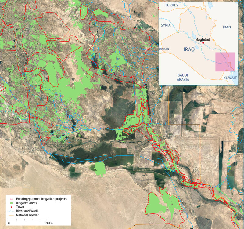
A plan designed by the Ministry of Water Resources in the 1980s led to the implementation of a more modern type of irrigation and drainage. Agriculture and marshlands were viewed as antithetical and the marshlands were drained to make way for croplands and other development projects.
In subsequent years, this approach was found to be deeply flawed and, today, more holistic, sustainable approaches that recognize the give and take between agricultural lands and marshlands are gaining ground. For many reasons, including groundwater recharge, microclimate effects, soil salinity and quality improvements, and expansion of future agricultural areas, marshlands have proven to be vital and complementary partners in agricultural development.[9] As a result, the plan designed in the 1980s was updated and incorporated into the Strategy for Water and Land Resources (SWLRI), which was finalized by the Ministry of Water Resources in 2015.
Impact of petroleum development
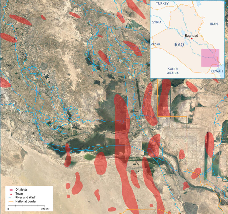
Southern Iraq is home to around 5% of the world’s total oil reserves. Since the first oil was discovered in 1902 in the north of Iraq, a total of over 70 possible fields have been found, of which only 15 have been developed. The southern fields are generally anticlinal trap structures producing from relatively shallow depths, although deeper production zones are likely present.
To date, the development of oil production facilities has necessitated the drainage of about 5%-10% of the total marshland area. Future development of oilfields within the area may necessitate additional drainage of the marshlands, and such developments should be integrated into the sustainable development strategy to allow for appropriate consideration of the land-use needs of the local inhabitants, ecosystem conservation and agriculture.
The 1990s drainage programme
The marshlands suffered large-scale destruction during the Iraq-Iran War (1980-1988). The Hawizeh Marsh was partially desiccated, and the construction of a road across the Central Marsh parallel to the west bank of the Tigris effectively bisected the marshes from north to south.
This was followed in the early 1990s by a massive drainage programme through the construction of several diversion canals aimed at taking water directly to the existing channel network and finally to the sea. Officially, the programme was carried out to meet land development targets. In reality, following the First Gulf War, the marshes had become a centre of Iraqi opposition against Saddam Hussain. The drainage programme is thus believed to have been a means to flush out hiding rebels. After the desiccation of the marshlands, the dried reed beds and villages constructed of reeds were burned.
One of the main interventions that permanently changed the landscape and environment was the Glory River construction, with its large, straight course that cut across the Central Marsh from north to south.
The marshes in the 21th century
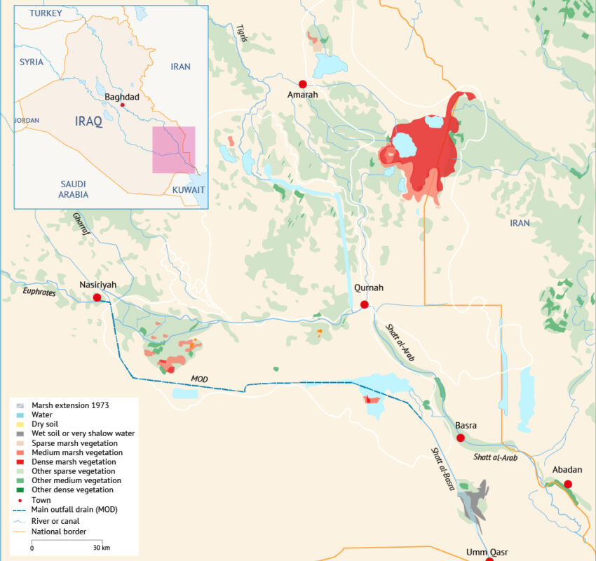
By 2002, the marshes had shrunk to 1,600km2 or 14% of their size in 1970s. Conditions in 2002 are considered to be the lower limit of the marshlands’ extent. Hammar Marsh was almost completely dry. Map 6 shows satellite imagery of the marshes taken before and after major desiccation projects were implemented.[10]

Re-flooding the marshes
Following the invasion of Iraq by coalition troops in 2003, the people who had remained around the fringes of the dried-out marshes did not wait for Baghdad to fall to begin re-flooding. The first two levees to be breached were close to Basra, at the tail end of the Hammar Marsh. Water flowed up from the Shatt al-Arab River to the lower reaches of the Hammar.
Further west, along the south-westerly side of the Central Marsh, the locals asked the manager of the irrigation district to use his equipment to breach the embankments. This allowed water to re-flood the Abu Zirig Marsh. Similarly, the locals in the northwest corner of the Central Marsh prevailed upon the operator of the pumping station to stop pumping, causing the marsh to flood. Three breaches were also opened in the left levee of the Euphrates, allowing water to flow into the Central Marsh, and around Hawizeh Marsh various dykes and levees were opened.
At the same time, the central government acknowledged the importance of providing institutional support to the wetland area, and the Center for Restoration of the Iraqi Marshlands (CRIM) was established in January 2004. The CRIM’s short-term goal was to support the implementation of proposals for marsh restoration, following several donor investments in the area. Marsh rehabilitation efforts included re-flooding and monitoring; research; planning; training and capacity-building; and establishing international agreements. Further, several groups initiated projects to increase the prosperity of the marsh dwellers. The CRIM’s final target was the preparation of a Sustainable Restoration Plan.[11]
Marshlands observation programme
In 2003-2005, the Iraq Marshlands Observation System (IMOS) was part of the United Nations Environment Programme’s (UNEP) Support for Environmental Management of the Iraqi Marshlands project. IMOS was a decision-making support tool to assist key stakeholders in modifying and adapting restoration plans in a timely manner, based on valid scientific information. The main goals of IMOS were to:
- Develop and implement a monitoring system to systematically acquire, analyse and exchange information about changes in the marshlands ecosystem;
- Develop information products and services based on the data gathered to support management of the restoration process; and
- Evaluate the success of wetland restoration and its impacts on the regional environment, including that of the northern Persian Gulf.
The main tool used for the implementation of IMOS was based on remote sensing-derived vegetation analysis. The resulting images, updated on a weekly basis, provided the measurement of open water and marshlands vegetation coverage, as shown in Maps 7 and 8.
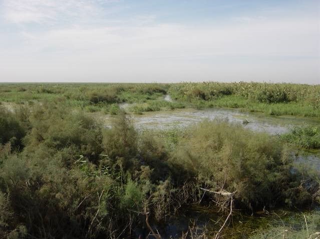
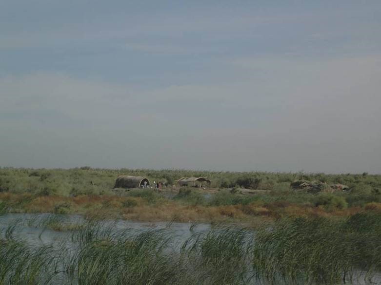
While the remote sensing observation programme implemented by UNEP was ended in 2006, the New Eden Team continued the project, using similar methodological approaches. Monitoring was based on satellite images collected every month from December 2007 until October 2008.
The role of marshlands in the current water management framework
Marshland flooding dynamics – natural conditions
The extent of the flooded areas is subject to variability during the year, according to the hydrological regime. Dry years lead to a reduction of the flooded areas, while wet years contribute to an increase in the extent of the marshlands.
The marshlands’ natural inflow-outflow system strongly depends on the presence of flood peaks and, generally, on the hydrological regime of the rivers, that bring water to the marshlands. Before humans intervened in the hydraulic system, the area upstream of the marshlands was periodically inundated during floods. Conversely, during droughts, the extent of the inundated areas decreased, causing an alternation in the wetlands’ behaviour, and generally helping the development of biodiversity and optimizing environmental conditions: the variation of the flood extension and water depth create favourable conditions for flora and fauna. Moreover, man-made levees and embankments did not exist under natural conditions. Thus, there was less physical limitation to the extent of inundation, except for the natural levees and gradual changes in terrain elevation. Large flow peaks entered these wetlands and floods were naturally attenuated as water extended over the floodplain. Large volumes of water moving through the wetlands helped maintain a high level of connectivity between the various marshes and rivers.
Marshland flooding dynamics – current conditions
Nowadays, the marshes are managed completely differently: the presence of dams, man-made levees and embankments allows for full control of how water enters the marshes and where it flows. Dams and levees were built to enable and protect human activities. An immediate consequence of the construction of dams was the disappearance of peak flows from the rivers and the reduction of total available water for southern Iraq. At the same time, the construction of an extensive levee system imposed physical constraints on the amount of land potentially available for marshland development as well as the connectivity between marshlands and rivers.
In these conditions, marshes are no longer connected one to another, and if some connectivity still exists, it is only because the local population has breached the existing levees, or because a man-made canal brings water from one place to another.
The lack of peak flows and hydro-periods, the reduction in water availability and the lack of hydrological connectivity are all contributing to the existence of an unhealthy and unstable marshland system.This marshland flow management, which has been extensively applied in southern Iraq in the past decades, can be referred to as ‘semi-natural’: inflows to the marshes are fully controlled, whereas outflows are unmanaged, although not natural. Unfortunately, it is a losing strategy, as large flows are no longer guaranteed and flow variation inside the marshes cannot be mimicked without an adequate artificial system.
Recognizing that both ‘natural’ and ‘semi-natural’ management is no longer feasible or adequate, the Ministry of Water Resources is currently pursuing ‘controlled’ management, a system where both inflows and outflows are fully controlled. Controlled management attempts to attain the necessary flow-through and water-level variations required by the ecological system to thrive. From a hydraulic standpoint, controlled management operates by preventing or limiting the water flowing out from the inundated areas. It is not only a feasible option but also the most water-efficient.
From 2008 to 2010, the Ministry of Water Resources supervised the design of the hydraulic structures necessary for the controlled flooding of the marshlands. Some of these hydraulic structures have been constructed in the last five years, in particular the outlets of the Hawizeh and Central Marsh.
Benefits of marshland restoration
The government has acknowledged the importance of the marshlands for both environmental conservation and water resource management. This was expressed in e.g. the New Eden Master Plan in 2006-2008 and the SWLRI strategic plan in 2015. In addition, concrete actions have been taken, such as the approval on 23 July 2013 by the Iraqi Council of Ministers for the Central Marsh to be designated as the country’s first national park.
The marshes perform a variety of ecosystem services, including:
- Hospitable environment that serves communities, and reduces the occurrence of migration from the marshes to urban centres;
- Carbon sequestration, i.e. absorption of carbon dioxide (CO2) from the atmosphere by the vegetation growing in the marshes;
- Flood hazard mitigation;
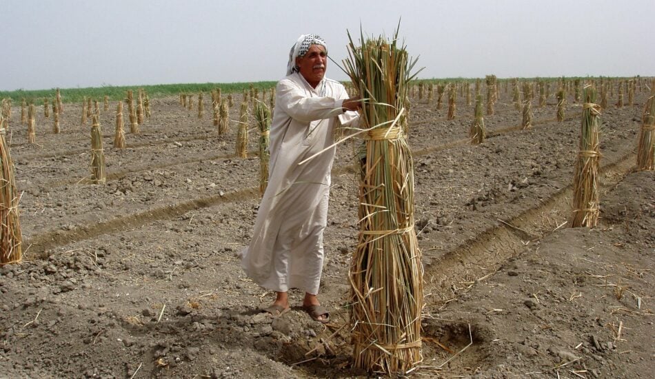
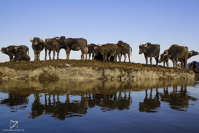
- Production and sale of goods from the marshes, including dairy products from water buffalo, milk from cows, fish, reeds, etc.;
- Groundwater recharge;
- Water purification, i.e. wetlands naturally help to reduce pollutants because wetland plant species absorb some constituents in the marsh water;
- Prevention of erosion, sand or dust storms and desertification;
- Improved microclimate, including lowering local temperatures and increasing local humidity;
- Improved soil structure through the rehydration and introduction of organic matter;
- Increased land value;
- Ecological tourism.
The New Eden Plan computed a valuation of the marshlands based on various ecosystem function parameters, including direct use value attributed to direct utilization of ecosystem services, and indirect use value attributed to indirect utilization of ecosystem services through the positive externalities that ecosystems provide. The computation[14] estimated the value of the marshes to be equivalent to $3.4 billion per year, if the marshes were restored to their full historical boundaries. This valuation amounts to approximately $3,370 per hectare of marshes per year.
An analysis of nearly 170 international inland wetlands indicates that the ecosystem services provided by these wetlands have an annual value ranging from $5,500 per hectare to approximately $110,000 per hectare. The average unit value of the surveyed inland wetlands in this analysis is $28,000 per hectare per year.[15] Thus, the estimation in the New Eden Plan is conservative compared with the international valuation of similar ecosystems. It should also be noted that even at this conservative valuation, the restoration of the marshes produces an economic return which is comparable to (if not higher than) agriculture for the governorates of southern Iraq.
Outlook
As mentioned in the previous sections, the government has acknowledged the strategic role of the marshlands in Iraq’s current and future natural resources management.
Defining the boundaries of the marshland and formalizing a national vision regarding the area will facilitate long-term protection. The designation of the Central Marsh as the country’s first national park in 2013 was the first step in this direction. Similarly, the CRIM identified a target extension of the wetland areas,[16] in an attempt to balance environmental needs with agriculture and oil extraction programmes. In July 2014, the Ministry of Water Resources committed to develop joint plans and activities for the conservation and wise use of wetlands with the Ramsar Convention, an international treaty that entered into force in 1980, and to collaborate in the management of the Hawizeh Marsh,[17] which was registered on the convention’s List of Wetlands of International Importance in 2007. It should be noted that the management of the Hawizeh Marsh has to contend with hydraulic regulators, built in 2010-2011 along the border by the Iranian government, which further impacts the marsh inflow.
In 2013, the Center for Restoration of the Iraqi Marshlands (CRIM) launched a project to develop the National Atlas of Marshes and Wetlands in Iraq, a requirement of the Ramsar Convention. The project identified a long list of potential sites, focusing first on the Central and Hammar marshes.[18] And in 2016, UNESCO named the marshlands a World Heritage site.[19] Known in full as The Ahwar of Southern Iraq: Refuge of Biodiversity and the Relict Landscape of the Mesopotamian Cities, the inclusion of the site represents international recognition of its outstanding universal value. The site comprises seven components: four wetland marshes, namely the Hawizeh, East and West Hammar and Central marshes, and the three archaeological sites of Ur, Uruk and Eridu.
Conclusions
Sustainable development in Iraq goes hand in hand with the restoration and preservation of the ecological health of the Iraqi Marshes. The provision of a consistent and reliable quantity of water is the first step. In parallel with this effort, identification of water-quality targets for the flow entering the marshes is extremely important for the people living in the area as well as the wildlife, aquatic species, livestock and agriculture. With water quantity and quality targets identified, successful water resource management requires functioning infrastructure (such as gates, weirs and embankments) to control the inflow to and outflow from the marshes as well as the cross-flows between marshes.
[1] Food and Agriculture Organization of the United Nations (FAO). Iraq Country Profile. Available at: www.fao.org/ag/agp/AGPC/doc/Counprof/Iraq/Iraq.html, accessed 6 February 2017.
[2] Sanlaville, P. (2002). ‘The Deltaic Complex of the Lower Mesopotamian Plain and its Evolution through Millennia’. In The Iraqi Marshlands: A Human and Environmental Study. Nicholson, E. and Clark, P. (eds).
[3] Aqrawi, A.A.M. (1993). Implication of sea-level fluctuation, sedimentation and neotectonics for the evolution of the marshlands (Ahwar) of southern Mesopotamia. Quaternary Proceeding No. 3: 17-26.
[4] New Eden Group (2006). New Eden Master Plan for Integrated Water Resources Management in the Marshlands Area. Final report prepared for Iraq’s Ministries of Water Resources, Municipalities and Public Works, and Environment.
[5] Ibid.
[6] Elaborated from New Eden Group (2006), cited above, and Ministry of Water Resources (2014), Strategy for Water and Land Resources of Iraq 2015-2035.
[7] New Eden Group (2006). New Eden Master Plan for Integrated Water Resources Management in the Marshlands Area. Final report prepared for Iraq’s Ministries of Water Resources, Municipalities and Public Works, and Environment.
[8] Schilstra J. (1962). ‘Irrigation as a soil and relief-forming factor in the lower Mesopotamian plain’. Netherland Journal of Agriculture Science, 10 (3).
[9] New Eden Group (2006). New Eden Master Plan for Integrated Water Resources Management in the Marshlands Area. Final report prepared for Iraq’s Ministries of Water Resources, Municipalities and Public Works, and Environment.
[10] United States Geological Service pictures, from New Eden Group (2006). New Eden Master Plan for Integrated Water Resources Management in the Marshlands Area. Final report prepared for Iraq’s Ministries of Water Resources, Municipalities and Public Works, and Environment.
[11] Powers, K. (2004). The Iraq Marshes: Restoration Activities. CRS Report for Congress. Available at http://congressionalresearch.com/RL32433/document.php?study=The+Iraq+Marshes+Restoration+Activities, accessed 10 February 2017.
[12] New Eden Group (2006). New Eden Master Plan for Integrated Water Resources Management in the Marshlands Area. Final report prepared for Iraq’s Ministries of Water Resources, Municipalities and Public Works, and Environment.
[13] Ibid.
[14] New Eden Group (2006). New Eden Master Plan for Integrated Water Resources Management in the Marshlands Area. Final report prepared for Iraq’s Ministries of Water Resources, Municipalities and Public Works, and Environment.
[15] De Groot, R. et. al. (2012). ‘Global estimates of the value of ecosystems and their services in monetary units’. Ecosystem Services, 1: 50-61.
[16] Ministry of Water Resources (2015). Strategy for Water and Land Resources of Iraq 2015-2035.
[17] Ramsar Convention (2014). ‘Iraq: Ministries of Environment and Water Resources collaborate for the conservation of marshlands of international importance’. Available at: www.ramsar.org/news/iraq-ministries-of-environment-and-water-resources-collaborate-for-the-conservation-of, accessed 6 February 2017.
[18] CRIM (2013). The National Atlas of Marshes and Wetlands in Iraq.
[19] UNESCO (no date). The Ahwar of Southern Iraq: Refuge of Biodiversity and the Relict Landscape of the Mesopotamian Cities. Available at: http://whc.unesco.org/en/list/1481/, accessed 6 February 2017.

