
Iran has several large rivers, but the only navigable one is the Karun, the others being too steep and irregular. The Karun, with a total length of 890km, flows through the south-west of the country to the Shatt al-Arab, which is formed by the Euphrates and Tigris in Iraq after their confluence. The few streams that empty into the Central Plateau dissipate into the saline marshes. All streams are seasonable and variable. Spring floods do enormous damage, while there is little water flow in summer when most streams disappear. Water is, however, stored naturally underground, finding its outlet in subterranean water canals (qanats) and springs. It can also be tapped by wells.[1]
Traditional water collection and distribution systems: Qanat
A qanat is a water supply system; consisting of an underground tunnel connected to the surface by a series of shafts. The system uses gravity to transport water from the water table to the mazhar or outlet (Figure 1).[2] The main, or mother, well is generally excavated in the mountains, penetrating deep into the water table. Water runs down a slightly sloping tunnel, gradually increasing in volume until it emerges near farms or communities.

Water from qanats is brought to the surface where the soil has been enriched by sediments from alluvial fans. Cultivated land and settlement sites are situated downwards from the point where the water surfaces.
The immediate outlet is the point where people withdraw water, and is generally located in the main square of a village. The outlet is very important; it is well kept and cemented to ensure water equity and quality.[3]
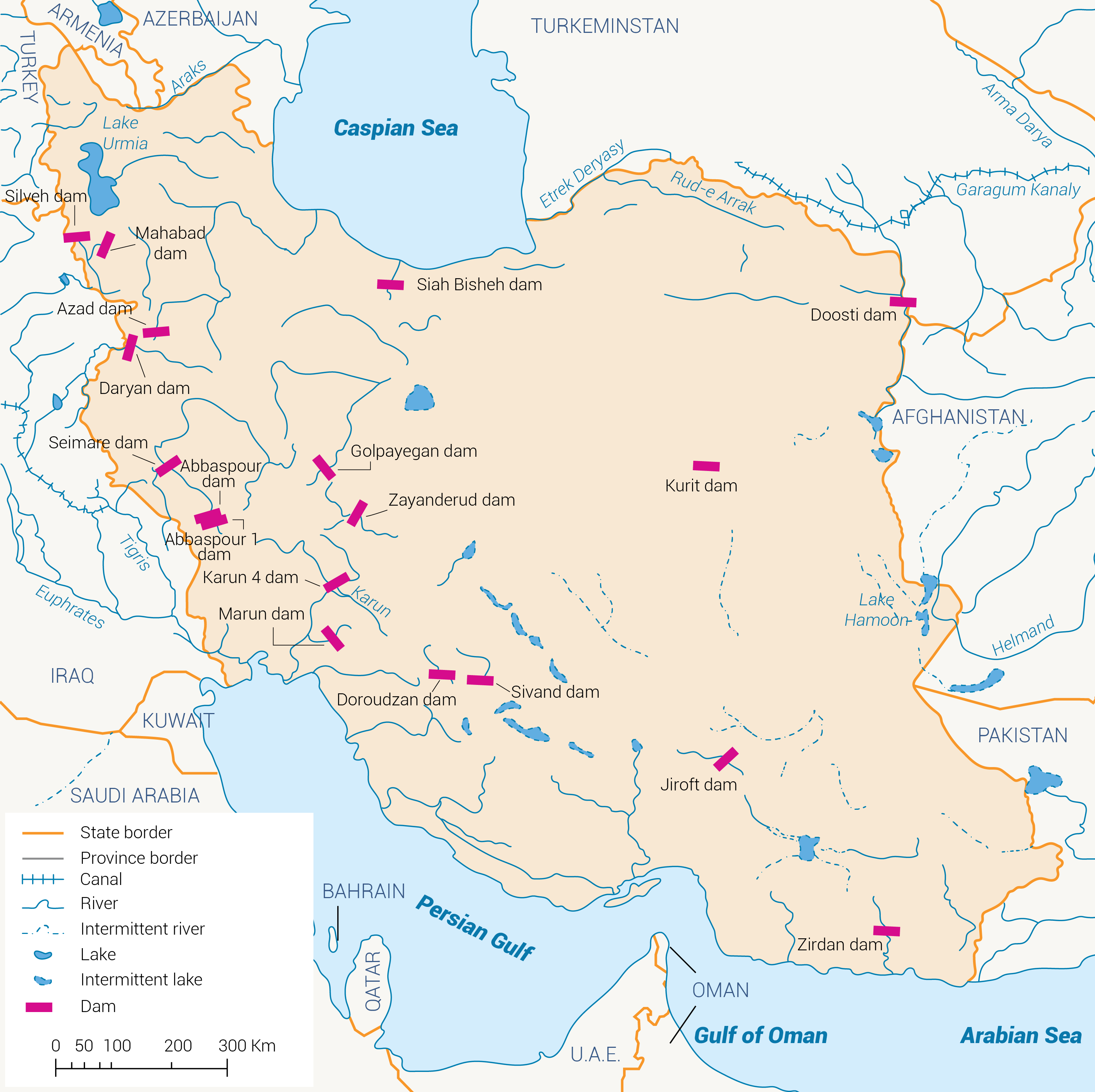
Dams
Dams have always played an important role in harnessing precious Iranian water reserves. Accordingly the long-term objective of Iran’s water resources development plan is based on the control and regulation of water through dams. In 2016 , a total of 647 dams were in operation, of which 523 are considered large dams. The total capacity of all dams is 51.7 BCM. The largest 176 reservoir dams have the capacity of 49.2 BCM, almost 95% of the total volume of the operated dams. The hydroelectric power plants generated gross electricity of 15765098 1000 kWh in 2016.[5] Aside from hydropower, dams also play an important role in flood control through the routing of floodwater. Several reservoirs behind the dams would seem to offer good sailing and water-skiing facilities, but have not been used for recreation so far.[6]
Wastewater treatment
In 2016, about 51% of the country’s population was covered by the sewage collection network. The average volume of collected wastewater was 6039,958 cubic meters performed by 182 in-operation sewage treatment plants around the country. In the same year, the number of under-construction and-under design sewage plants was 17 and 28 respectively.[7]
[1] AQUASTAT, 2008. Country Fact Sheet: Iran. FAO’s global information system on water and agriculture. Available at www.fao.org/nr/water/aquastat/countries_regions/irn/index.stm.
[2] Ibid.
[3] Ibid.
[4] Sadeghi, N. et al., 2008. ‘Indigenous knowledge responding to global changes: qanats an ancient sustainable tool for groundwater management’.
[5] The Statistical Centre of Iran, 2019. Iran Statistical Yearbook 1397 (2018 – 2019). Available at https://www.amar.org.ir/english/Iran-Statistical-Yearbook/Statistical-Yearbook-2018-2019
[6] The International Commission on large Dams – Iranian National committee. Available at https://ircold.ir/en/dams-in-iran/.
[7] The Statistical Centre of Iran, 2019. Iran Statistical Yearbook 1397 (2018 – 2019). Available at https://www.amar.org.ir/english/Iran-Statistical-Yearbook/Statistical-Yearbook-2018-2019