
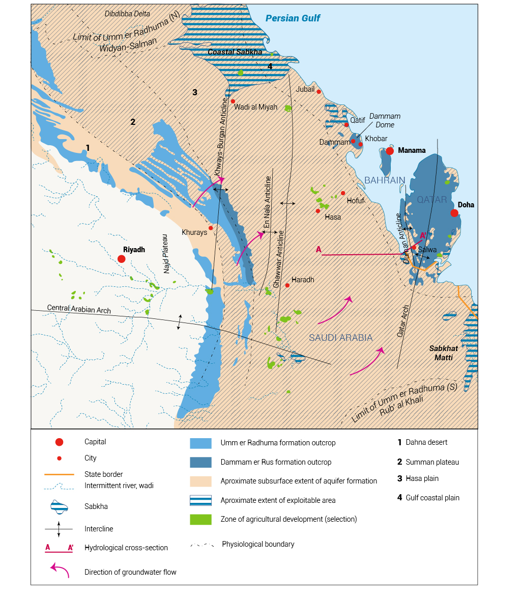
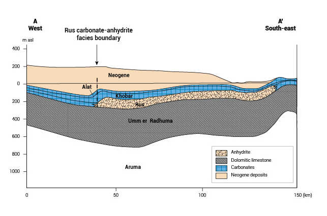
The Umm er Radhuma-Dammam Aquifer System extends from northern Iraq to the southern coast of the Arabian Peninsula over a distance of 2,200 km. Overall, it covers an area of more than 1.2 million km2. This system generally comprises three formations: the Dammam, the Rus and the Umm er Radhuma (Map 1).[1] Map 2 shows the hydrogeological section of the Umm er Radhuma-Dammam Aquifer.
The central section of the system extends over a 400 km-wide structural platform that stretches across Bahrain, Qatar and Saudi Arabia. In the western low plateau areas, the system is dominated by the Umm er Radhuma, while in the eastern plains it becomes more complex as the Umm er Radhuma and the Dammam are separated by the Rus Formation. The central section covers a total area of 281,000 km2, of which about 560 km2 are located in Bahrain, 11,300 km2 in Qatar and 269,000 km2 in Saudi Arabia. The largest outcrop of the Dammam Aquifer covers almost all of Qatar, with smaller outcrops across Bahrain and around the city of Dammam in Saudi Arabia. The Umm er Radhuma only crops out in Saudi Arabia. The Rus is found in the subsurface across the whole region, separating the two main aquifer units.[1]
Recharge to any aquifer within the system can occur from rainfall (directly or via runoff) or transfer of water by vertical flow from shallower or deeper aquifers. Estimated rainfall-related recharge was 27 MCM/yr (approximately 2.4 mm/yr) for the period 1962/1963-1979/1980, with a minimum of 0.5 MCM and a maximum of 85.75 MCM. Direct rainwater infiltration accounts for about 2% of recharge and indirect infiltration through wadis for about 10%.[1]
Continuous overexploitation of the Umm er Radhuma-Dammam Aquifer System has rendered the groundwater prone to salinization. This may make the aquifer unsuitable for use in the future. The unsustainable use of the system over the past 30-40 years, and the resulting salinization and drop in water table, have already restricted the use of this system in Bahrain and possibly in some parts of Qatar and Saudi Arabia. The Dammam and Rus formations, which used to be the only source of fresh water in Bahrain and Qatar respectively, are particularly at risk of salinization and/or total depletion.[1]
There are no water agreements in place for the central section of the Umm er Radhuma-Dammam Aquifer System, which is shared by Bahrain, Qatar and Saudi Arabia.[1]
[1] United Nations Economic and Social Commission for Western Asia; Bundesanstalt für Geowissenschaften und Rohstoffe, 2013. Inventory of Shared Water Resources in Western Asia.